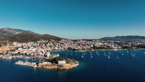
Phaselis is an ancient coastal town located in Antalya Province, in the Mediterranean region of Turkey. It is situated on the southern coast, between Antalya and Kemer, along the Lycian Way. Phaselis is known for its archaeological ruins, natural harbors, and beaches. The town’s location provides access to both historical sites and Mediterranean coastal landscapes.
Phaselis Overview
Location: Antalya Province, Mediterranean coast of Turkey
Primary features: Ancient ruins, natural harbors, beaches
Time needed: 1 day minimum, 2-3 days to explore surrounding areas
Best time to visit: April to October (warm and dry season)
Cost level: Low to medium compared to major Turkish cities
Tourism profile: Cultural tourism, beach visits, hiking
Reasons Travelers Visit Phaselis
Historical significance as an ancient Lycian and Roman port city with ruins
Three natural harbors providing beach and swimming opportunities
Mediterranean coastal climate suitable for outdoor activities
Located along the Lycian Way hiking trail
Proximity to Antalya and other Mediterranean towns
Best Time to Visit
The warm and dry season from April to October is the best period to visit Phaselis. Summer months (June to August) experience hot temperatures and higher crowd levels. Spring (April-May) and early autumn (September-October) offer milder temperatures and fewer visitors. Winters are mild but wetter, with reduced accessibility to archaeological sites due to weather.
Season
Months
Weather
Crowd Levels
Spring
April – May
Mild, mostly dry, temperatures 15-25°C
Low to medium
Summer
June – August
Hot, dry, temperatures 25-35°C
High
Autumn
September – October
Warm, dry to moderate rain, temperatures 18-28°C
Medium
Winter
November – March
Cool, wetter, temperatures 10-15°C
Low
How to Get There
Phaselis is located approximately 45 kilometers southwest of Antalya city center. The nearest major city is Antalya, which has an international airport and various transport connections. Access to Phaselis is mainly via road from Antalya or other nearby towns. Public and private transport options are available but may require transfers.
Nearest major city: Antalya (Antalya Airport)
Transport modes: car rental, bus, taxi
Road access via D400 highway and local roads
Approximate travel times vary by origin
Getting Around
Limited local public transport; taxis and car rentals are common
Phaselis archaeological park is walkable; distances between ruins and beaches are up to 2 km
Walking trails connect beaches and ruins within the town area
Nearby hiking trails on the Lycian Way
Top Attractions in Phaselis
Phaselis Ancient City Ruins
Ruins of an ancient Lycian and Roman port city including aqueducts, agoras, necropolis, and theater. Archaeological site. Average visit duration: 1.5 to 2 hours.
Phaselis Beaches
Three beaches along natural harbors providing swimming and sunbathing. Natural coastal sites. Average visit duration: 1 to 3 hours.
Olympos Beydağları National Park
Protected national park surrounding Phaselis with hiking trails, forested mountains, and diverse flora and fauna. Natural site. Average visit duration: 2 to 4 hours.
Phaselis Museum and Visitor Center
Small museum with artifacts and information about Phaselis history. Museum. Average visit duration: 30 to 45 minutes.
Common Visitor Activities
Exploring archaeological ruins on foot
Swimming and sunbathing at natural beaches
Hiking sections of the Lycian Way near Phaselis
Visiting Olympos Beydağları National Park trails
Photography of ancient structures and coastal landscapes
Suggested Phaselis Visit Duration
A minimum of one full day is recommended to explore the archaeological ruins and relax on the beaches. Two to three days allow inclusion of hiking in the national park and visits to nearby areas such as Olympos and Mount Tahtalı.
Mount Tahtalı (Olympos Teleferik) – approximately 25 km northwest
Practical Information
Category
Details
Climate
Mediterranean: hot dry summers, mild rainy winters
Seasonality notes
Most visitors between June and September; some archaeological areas may close during winter rain
Crowd levels
High in summer; low in winter
Constraints or limitations
No direct public transport from major cities; uneven terrain at ruins; limited facilities in peak season
Frequently Asked Questions
What type of travelers visit Phaselis?
Phaselis attracts cultural tourists interested in ancient history, hikers on the Lycian Way, and visitors seeking natural coastal environments. The site appeals to travelers who prioritize archaeological sites, beaches, and outdoor activities.
How many days are needed to visit Phaselis?
One full day is sufficient to explore the ancient ruins and beaches. Visitors planning to hike nearby trails or explore adjacent destinations should allocate two to three days.
Is Phaselis safe for travelers?
Phaselis is generally safe for visitors. Standard precautions apply, such as monitoring weather conditions during outdoor activities and using sun protection. Accessibility to sites may be affected during winter rains.
What is the best time to visit Phaselis?
The best time to visit is from April to October due to warm, dry weather suitable for outdoor activities. Crowd levels peak in summer months, while spring and autumn offer milder conditions with fewer visitors.
Get detailed travel guides for Turkiye's most popular regions, including the Mediterranean coast, Cappadocia, Istanbul and more. Each guide is packed with local insights, recommended routes and practical tips to help you explore like a local.